
ЛЭП, отметки изоляторов и провис проводов.
Проверка точности
Проверка точности
Немного об обследовании ЛЭП с беспилотников
В настоящее время обследование ЛЭП с использованием беспилотных летательных аппаратов получило достаточно широкое распространение. Данные съемки используются для кадастра, инженерно-геодезических изысканий, проектно-изыскательских работ и др. Довольно часто возникает вопрос: можно ли с использованием БПЛА получить высотные отметки ЛЭП, провисы, габариты провода и другие метрические характеристики? И с какой точностью?
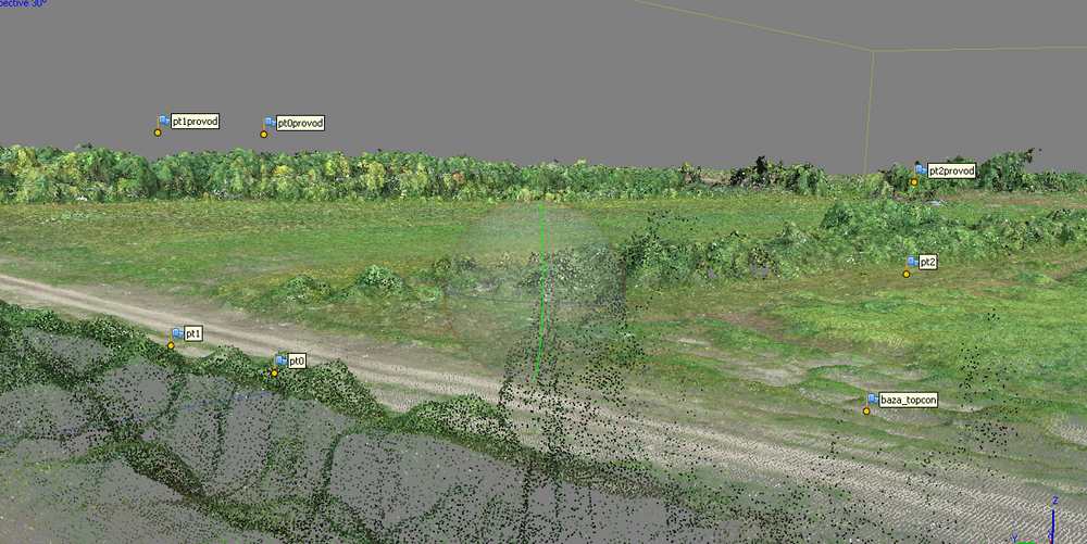
Основным сенсором БПЛА является фотоаппарат. Трехмерное изображение строится на основе перекрывающихся фотографий и информации о точных центрах фотографирования. Но как всегда везде есть нюансы. Обработав набор снимков ЛЭП в фотограмметрическом софте, вы не увидите опор и проводов в 3D. Максимум, что возможно получить, это плотное облако опоры. И то, к сожалению, построятся только единицы опор из многих. Пример ниже:
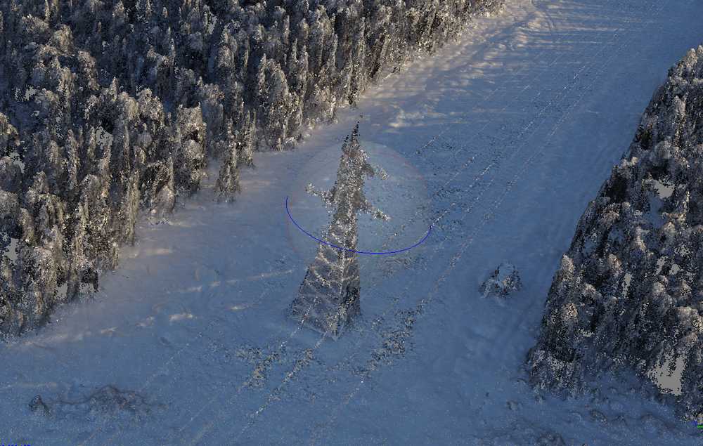
Провода ЛЭП в фотограмметрическом софте не восстанавливаются в 3D, т.к. это очень тонкий объект для фотограмметрии. Программа просто не видит длинную нитку толщиной в несколько пикселей.
В этом случае на помощь приходит компьютерное зрение и есть целый ряд разработок различных компаний по автоматизированному поиску проводов, габаритов и пр.
Не имея большого штата программистов, компания «Аэрострим» разработала технологию определения отметок провода, используя стандартные инструменты.
В результате, с высокой точностью, можно получить отметки проводов и земли в любом месте и решить производные задачи: определение габаритов, провисов, углов поворотов и др.
Проверка точности измерений высотных отметок проводов ЛЭП с использованием БПЛА
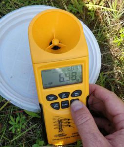
Для того, чтобы проверить точности отметок проводов ЛЭП, компания «Аэрострим» выполнила съемку небольшого участка. Было выбрано несколько пролетов двухцепной ЛЭП. На этом участке в разных местах были заложены опознаки под проводами. Координаты всех опознаков были измерены с использованием ГНСС EFT M3 в RTK режиме от сети Геоспайдер. С использованием измерителя высоты кабельных высоковольтных линий AR600E от каждого опознака была измерена высота пролегания до нижнего провода.
Таким образом, инструментальным способом были получены габариты проводов для каждого опознака. Теперь оставалось выполнить аэрофотосъемку участка и определить высоту провода над опознаком фотограмметрическим методом, только основываясь на данных съемки с беспилотника. В заключительной части мы сравним данные измерений, полученных с беспилотника и инструментальным способом.
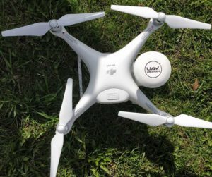
Съемка с воздуха выполнялась геодезическим квадрокоптером Phantom 4 Pro v2 PPK от uav-design.com
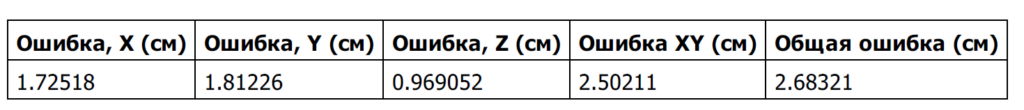
Геодезические центра фотографирования были обработаны в ПО Magnet Tools. Фотограмметрическая обработка производилась в Photoscan Pro (Metashape). Залет был сделан с высоты 100 метров в два пролета. Технология съемки с геодезического дрона uav-design позволяет получить хорошие результаты по точности. В нашем залете, камеры выровнялись относительно друг друга с ошибкой в среднем до 2 см по осям. Чем меньше ошибка взаимного положения камер, тем точнее будут отметки провода:
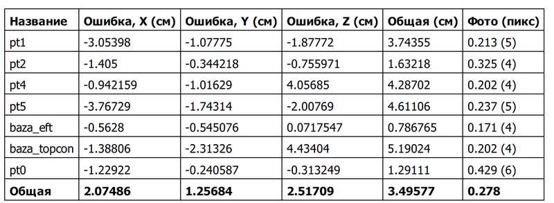
СКО на наземных контрольных точках также составили несколько сантиметров:
По собственной технологии были отмечены отметки проводов ЛЭП в местах над опознаками. Всего было взято фотограмметрическим методом 5 отметок на разных участках 2х пролетов ЛЭП
В итоговой таблице ниже приведена разница в высоте проводов, измеренных инструментальным методом и фотограмметрическим. Максимальные отклонения составили 12 см, в среднем отклонения составляютт несколько см
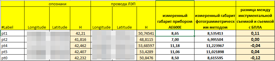
Вывод: Фотограмметрическая съемка ЛЭП с беспилотников по технологии, отработанной в компании «Аэрострим», позволяет вычислить отметки провода с точностью порядка 5-12 см, по сравнению с инструментальной съемкой.


